
By Allison Campbell-Jensen
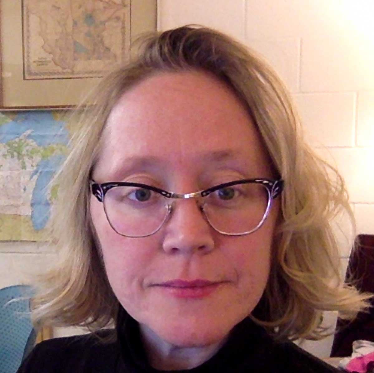
Karen Majewicz
The Big Ten Academic Alliance Geoportal relies on collaboration among a great many organizations, including the members of the GeoBlacklight community. GeoBlacklight is a platform that supports online searches in geospatial resources. The BTAA Geoportal resides at the University of Minnesota Libraries but its use of and involvement with the GeoBlacklight platform gives it a national presence through the work of Karen Majewicz, Geospatial Project Manager & Metadata Coordinator.
Last year, Majewicz was named GeoBlacklight Community Coordinator, taking on a title for the work she has been doing to try to broaden the community and also to help coordinate its work.
“In the past year, Karen has shown considerable leadership and has grown to be an indispensable member of the GeoBlacklight community,” says Eliot Jordan, GIS Developer at the Princeton University Libraries. “From running the monthly community calls to coordinating the effort to update the metadata schema, Karen has demonstrated that she is, truly, the glue that holds us together.”
Side-stepping into the role
Not long after Majewicz came to the Libraries in 2015 to help manage the BTAA Geoportal, the person doing the technical work moved to another university. It seemed she would need to take over some of that technical work because, she says, “in order for the project to be successful, we could not be just passive consumers of this GeoBlacklight software.” It is an open-source technology, which implies an ethos that users contribute voluntarily to maintain, fix, and enhance it.
Yet when she started attending the GeoBlacklight meetings, most of the participants were software developers skilled in Ruby on Rails — Ruby being the programming language and Rails the application framework. She did not have that expertise, but she did have project management skills and a background in metadata to share with the community.
Initially, Majewicz simply set up meetings but eventually moved into setting agendas. Lately, she has been “trying to coordinate activities to have a rudimentary roadmap for the application itself.” Last year, the community decided to turn this work into a named position of community coordinator.
The work is needed, she says. The GeoBlacklight community has grown from a small number of schools using it to about 18, counting projects in development. And there are more than just developers at the meetings. Now the meetings include “librarians, metadata specialists, GIS liaisons, or people good at documentation. The community is a lot stronger because we have actively tried to recruit having a broader group participating.”
Her efforts are appreciated by Ryan Mattke, Project Lead for the BTAA Geospatial Data Project and Head of the John R. Borchert Map Library.
“Karen leads by example and inspires others to maintain high levels of productivity and collaboration,” he says. “Through community building efforts and by leading thoughtful conversations, Karen is able to see what others are capable of accomplishing. This makes Karen an especially effective coordinator, as she is able to successfully direct the work of colleagues across the country so that they are all working toward a common good.”
Positive outcome
“Karen has been an instrumental partner in engineering GeoBlacklight for multi-institutional use.”
—Kim Durante Metadata Librarian for Geographic and Scientific Data at Stanford University
About a year ago, the GeoBlacklight community started talking about improving the metadata schema for the application. With several years of experience, the community understood more about how users interact with the schema and what different institutions need. “About 15 metadata librarians met regularly over almost a full year to systematically analyze the existing schema and to update it with an eye on usability and interoperability,” Majewicz says.
“She effectively managed a project with participants from many institutions over the course of a year to improve geospatial metadata,” says Mara Blake, Data Services Manager at Johns Hopkins University. The result of this work was a new schema, named Aardvark, that replaced efforts by some schools to come up with custom-made schemas and so made it much easier to share metadata records.
“I don’t know if that would have happened if I hadn’t been pushing the metadata side as well as the application side,” she says.
The result prevented detours in the roadmap of progress for GeoBlacklight.
“Karen has been an instrumental partner in engineering GeoBlacklight for multi-institutional use,” says Kim Durante, Metadata Librarian for Geographic and Scientific Data at Stanford University. “She has shown herself to be a highly skilled project manager through coordinating an evolving set of metadata requirements as well as feature enhancements for the software application.”
Another tool
Majewicz worked with consultant and application developer Eric Larson this year to build another tool, a metadata editor. “GeoBlacklight doesn’t come with a backend interface; it was built to be a top layer that is attached to your library’s repository,” she says. “But the Big 10 Geoportal doesn’t have a repository because we’re pulling from over 100 different sources. We’re just a metadata catalog.”
Majewicz pointed out the needs and did the testing on the metadata editor that Larson developed. It integrates with GeoBlacklight, manages the records and can do batch editing, batch exporting, and automatic publication of metadata. It’s called GEOMG.
Making connections
Partners in her work in the BTAA Geoportal and the national GeoBlacklight community praise Majewicz for her accomplishments and her approach.
“I learn so much from talking through metadata questions with her on the projects we’ve done together, and any time I’m stuck on an issue or I have an idea, I know I’m welcome to come to her and she’ll troubleshoot it with me effectively,” says Lena Denis, Geospatial Data, GIS, and Maps Librarian at Johns Hopkins University.
When a newcomer to the GeoBlacklight community, Michelle Janowiecki, Digital Content Metadata Specialist at Johns Hopkins University, was welcomed by Majewicz and made to feel included. “Her thoughtfulness, organization, kindness, and expertise are seen within every major GeoBlacklight community project, event, and improvement,” she adds.
“Our community is very lucky to have her.” As are the BTAA Geoportal project team and the University of Minnesota Libraries.