
By Adria Carpenter
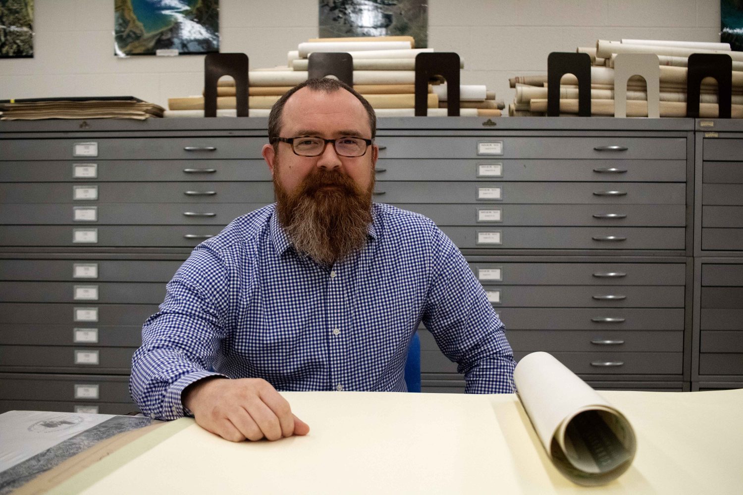
University of Minnesota Map and Geospatial Information Librarian Ryan Mattke poses for a portrait in the John R. Borchert Map Library on Thursday, May 18, 2023. (Photo/Adria Carpenter)
Ryan Mattke, the Map and Geospatial Information Librarian at the University of Minnesota Libraries, will be one of the newest members of the National Geospatial Advisory Committee (NGAC) in the U.S. Department of the Interior.
“It’s a big deal for me and for the University of Minnesota Libraries,” he said. “I am really excited.”
The NGAC, created by the Federal Geographic Data Committee in 2008 and reauthorized under the Geospatial Data Act of 2018, helps manage federal geospatial programs and develop a national spatial data infrastructure.
Mattke came to the University from Green Bay, Wisconsin to study creative writing and poetry. He became an undergraduate student worker in 2003 and soon joined the staff as a fulltime employee.
“I expected to stay for a couple of years and find something else, but I really enjoyed working in libraries,” Mattke said.
Since 2010, Mattke has been the head of the John R. Borchert Map Library, which houses over 600,000 items including 250,000 maps and 370,000 aerial photographs. He’s also the subject liaison to the Department of Geography, Environment and Society.
Place and Space
Geospatial data touches every aspect of our lives. Everything from food insecurity initiatives to urban planning uses geospatial data. Metro Transit, for example, uses it to create and operate its routes in the Twin Cities.
“Anything that’s related to place and space uses geospatial data,” he said. “It allows for the integration of diverse information from multiple sources, which supports academic research, as well as decision-making processes at all levels of government.”
Geospatial data also affects the economy. Mattke likes to use coffee shops as his classroom example. To find the best location for a new coffee shop, an entrepreneur could create a map of all current coffee shops overlayed with a layer of median household income and marketing data.
“You might look for spaces where there’s people that spend money on coffee, but there’s a low incidence of coffee shops in that area. And then maybe you’d locate there,” he said.
A novel approach
Mattke has a slightly different approach to the geospatial realm, which is often focused on technology and computer science, since he originally came from a humanities background. In 2016, he co-founded the Mapping Prejudice project, alongside Kirsten Delegard and several others, that sought to map racially restrictive deed covenants in Hennepin and Ramsey counties.
The project findings helped influence the City of Minneapolis zoning code revisions, and in 2018, the city banned single-family residential zones in every neighborhood. These zones were created in the 20th century and helped reinforce housing segregation, by restricting where people could live and what kind of people could live there.
Black and immigrant families were not permitted to live in some areas, either because they were denied loans via redlining, or were not permitted to buy homes because of racial covenants. Instead, these families were corralled into areas with low property values, which prevented them from amassing wealth through homeownership or forced them to rent.
Replacing single-family housing citywide with “missing middle” housing, like duplexes and triplexes, give people more affordable options and consequently helps breakdown legacy housing segregation.
Building a geospatial future
As the project lead for the Big Ten Academic Alliance Geospatial Information Network, Mattke is already prepared in developing and managing geospatial infrastructure.
The BTAA-GIN, created in 2016, connects scholars from Big Ten campuses to geospatial resources by creating and aggregating metadata, digitizing records and data sets, and developing open-source geospatial software. The network spans 14 institutions across 11 states, managed by a rotating staff of 25 librarians and specialists.
Mattke was first nominated to the NGAC in 2019 and has been waiting for his turn to serve on the committee. When the call finally came, it was a mixture of “excitement and relief.”
“I’m excited to bring an academic, but especially an academic library perspective to the NGAC,” he said. “Overall, the committee’s very focused on government and on public private partnerships, but I think there’s room for more of a focus on research, with an emphasis on archiving and preservation of data for long-term use.”
The University Libraries has paper maps from 500 years ago that are still readable today, he explained, but digital geospatial data may not be readable in the future, as outdated software gets replaced.
“Libraries do a lot of thinking around archiving and preservation,” he said. “So, I think that’s a perspective I can bring.”
Mattke believes it’s important to preserve geospatial information, so the next generation can use that foundational knowledge to make effective decisions that will shape our future.
Mattke will serve on the NGAC for the next three years, meeting three to four times a year at Washington D.C. But in the meantime, you can find Mattke in the sub-basement of the Wilson Library, making maps and quietly changing the country.