
By Allison Campbell-Jensen

Data Analyst Kate Knowles parlays physical maps used by the U. S. Census into digital Shapefiles.
Making a wealth of government information accessible — ideally, anywhere, anytime — is the goal of the University of Minnesota Libraries’ Government Publications Library.
The U of M Libraries has many partners in its accessibility mission, including users from the Minnesota Population Center, geographic information system researchers, writers, and students of all ages. In the Government Publications Library, researchers can “find all possible topics because the government does all kinds of things,” says Jenny McBurney, interim Government Publications Librarian.
Recently, the U.S. Government Publishing Office named the University of Minnesota’s Government Publications Library as the 2021 Federal Depository Library of the Year. It was selected for “consistently striving to make government information more discoverable and accessible, its commitment to preservation, and for ensuring Minnesotans access to this information in their local and regional communities.”
Still, if the Libraries were a map of North America, Government Publications might be the northern provinces of Canada: When thought of, often seen as distant and a bit forbidding, yet rich in resources and peopled by a hardy few who can help one navigate the vastness.
Making sense of the Census
“This whole project hinges on Government Pubs. I’m a huge fan.”
—Kate Knowles
In the era before electronic files were common, U. S. Census workers relied on physical, i.e., paper maps. These files describe geographically the counties, tracts, and blocks trodden by Census workers seeking to interview the individuals about their households. With the help of a team of student employees, Data Analyst Kate Knowles parlays physical maps used by the U. S. Census into digital Shapefiles.
When her project began, however, Knowles knew there were a variety of places around the country where some of these needed physical Census maps were being preserved — often with “Library Use Only” restrictions. To fill out the collection of 1980 Census maps, she called upon the then–Government Publications Librarian Alicia Kubas. (Kubas now is Supervisory Outreach Librarian at the U.S. Government Publishing Office.)
“She found us sources for every single map we needed,” Knowles says. “I just about cried when she sent me the spreadsheet.”
With essential guidance from Kubas, Knowles persuaded the librarians to loosen the leash, a bit, and lend their materials to the U of M for a time. With the physical maps gathered from faraway libraries (Georgia holds a particularly rich collection), Knowles and her team were able to complete the launching pad for their ambitious project.
Knowles emphasizes that her job includes helping people use this federal government data. Glancing over at her computer, one can see a sector of the southeastern United States spotted with dots — data destined for use by a School of Public Health researcher.
“This whole project hinges on Government Pubs,” says Knowles, of the U of M’s Institute for Social Research and Data Innovation (ISRDI). “I’m a huge fan.”
A researcher for all seasons
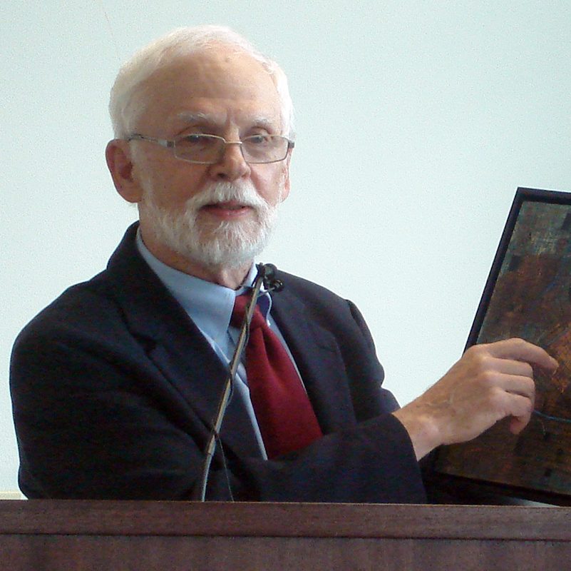
Will Craig
“I love librarians,” says Will Craig, “because they are so knowledgeable and always happy to help.” Reached via Zoom at his home overlooking the Mississippi River, Craig is Emerita Associate Director of the U of M’s Center for Urban and Regional Affairs, Fellow of the University Consortium of Geographic Information Science, and one-time student of the U’s late map expert John Borchert.
Following Borchert’s model, Craig may have officially retired at some point, but he stays very active in researching geographic information, particularly if it has an impact on local issues and policies.
“I was looking to understand the impact of the freeway on the Old Southside Black community of Minneapolis — the area between 38th and 46th Streets,” Craig says. He was seeking 1960 U. S. Census maps in Minneapolis, down to the block level, which only are available in print.
“It takes us a decoder to find it,” he says. … there’s this line table of numbers, but you’ve got to have a map that shows you where that block is.”
“I love librarians because they are so knowledgeable and always happy to help.”
—Will Craig
With Libraries staff Sara Westdal helping him to seek the Census primary-source materials, Craig says he was able to “do a pretty good job of mapping the black population in South Minneapolis, in 1960, when the [35W] freeway was being dug.”
His results showed the Old Southside was barely nicked by the freeway, which skimmed its western edge. But another Black neighborhood north of Lake Street did fall victim to the freeway: a cluster of city blocks south of Franklin Avenue and east of the Minneapolis Institute of Arts (mia).
“They disrupted that one as badly as anything that happened in the Rondo” neighborhood in St. Paul, which was bifurcated by the freeway. He adds. “One block alone had 44 black families on it. Boom — gone.”
Much more than the Census
Our Gov Pubs collects documents from the three branches of the federal government as well as all 50 states. The Gov Pubs staff curates lists of sources to use for online access as well, such as this guide that links to both free online and library subscription resources for US Federal government information.
Materials from the U. S. Departments of Agriculture, Commerce, Defense, Justice, and Labor, to name just some, are represented (some gov docs are held in Magrath and the Natural Resources Libraries, on the St. Paul campus); the Congressional Record is available; and also info from other countries and international bodies, like the United Nations and its predecessor, the League of Nations.
History lives
History can be unearthed in Gov Pubs, sometimes in microfiche, often in paper copies, and, more recently, through plenty of online materials.
For example:
- The 1804 Corps of Discovery, sent by U. S. President Thomas Jefferson to explore the huge territory purchased from France, is celebrated on the National Park Service’s website. “Lewis and Clark traveled over 8,000 miles in less than 2 1/2 years, losing only one member of their party, at a total cost to the taxpayer of $40,000.”
- Also online: the Pentagon Papers, once Top Secret, now declassified, complete, and accessible to the University community online and to the public through computers set up in the Government Publications section of Wilson Library.
Finding aids and aides
We, U. S. taxpayers, already have paid for this information to be collected, edited, and published; now all we need to do is find what information we want.
Dropping by Government Publications’s primary holdings area on the basement level of Wilson Library, this reporter spotted “The Final Report by the Select Committee to Investigate the January 6th Attack on the U. S. Capitol” (House Report 117-663). This tome of 814 pages — that includes appendices — may still be ready to be checked out.
Online are informative guides to Government Publications. Sometimes, however, one needs the human touch.
Fortunately, Libraries staffer Amy Gmur was eager to help when this reporter stopped by the Natural Resources Library to look for a gov doc: “Wildlife of the Lewis and Clark Expedition: A bicentennial journal.” Was it a book? Who knew? Fortunately, Gmur had an inkling.
“These [brochures] can be really hard to find,” she said, slipping into the stacks, and pulling out boxes. She emerged in just a few minutes with a sepia-toned brochure, its eight pages packed with information.
Speaking of discoveries: Did you know there is a Lewis’s Woodpecker, one of the many new species documented by the Corps of Discovery? And that during their long trek to the Pacific Ocean from St. Louis, Lewis and Clark and their group came into contact with nearly 60 indigenous tribes, who not only treated them with hospitality but also helped navigate their route to the Pacific Ocean?
Invaluable sources
Government Publications holds a pool of primary-source materials that is both deep and wide — and much appreciated by local author Stephen Chicoine. His books include “Our Hallowed Ground: The World War Two Veterans of Fort Snelling National Cemetery,” by University of Minnesota Press (available through the U of M Libraries), and “The Confederates of Chappell Hill, Texas: Prosperity, Civil War and Decline” (McFarland & Company).
Among the historic figures he has researched is a World War I Medal of Honor recipient who came back home to Minnesota to organize labor unions. George Mallon’s activities were cited, among other places, in U.S. Military Intelligence Reports surveilling “radicals,” including Socialist Eugene Debs and Elizabeth Gurley Flynn of the International Workers of the World (pejoratively known as “Wobblies”) in the 1920s. “These are treasures,” Chicoine says of the documents from the early 20th century.
He adds: “The University of Minnesota Libraries is a tremendous resource.” For an author like himself, he says, “It is one of the best reasons for living in the Twin Cities.”
Government Publications has it all — from a coffee table size book, “A Botanic Garden for the Nation,” to proceedings from a recent Department of Defense conference on the workings of China’s People’s Liberation Army — a world of information for anyone with a yen to explore.