
By Anne Good, Assistant Curator
Some time ago, I had the pleasure of listening to a “History Book Club” conversation between Prof. M.J. Maynes (History, U of MN – Twin Cities) and Dr. Emily Bruce (History, U of MN – Morris), concerning the latter’s new book, Revolutions at Home: The Origin of Modern Childhood and the German Middle Class. It was a great conversation about a really interesting book, and I was inspired by the discussion of geographical education for children to see what I could find on the topic in the Bell Library.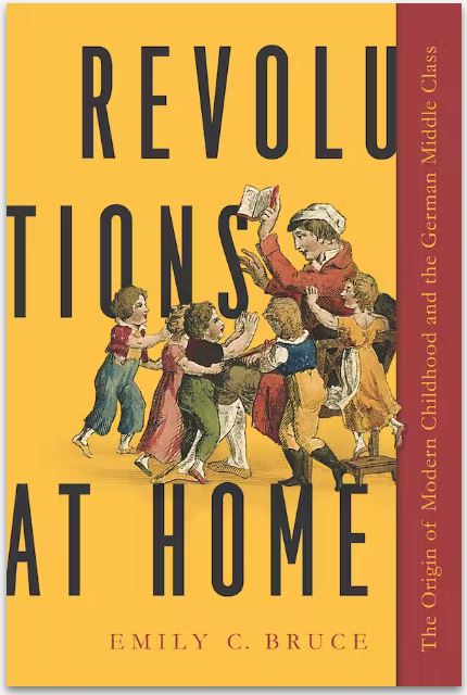
In her book, Emily explores the use of geographical texts and maps in the education of children. She argues that these materials inculcated in them a sense of their place in the world and their privileges as German, middle-class citizens. She draws on texts that specifically address children, and she looks for children’s responses to those texts in a variety of ways. Emily includes eighteenth-century materials in her analysis, but her focus on the roots of modernity nudges her more towards the 19th century.
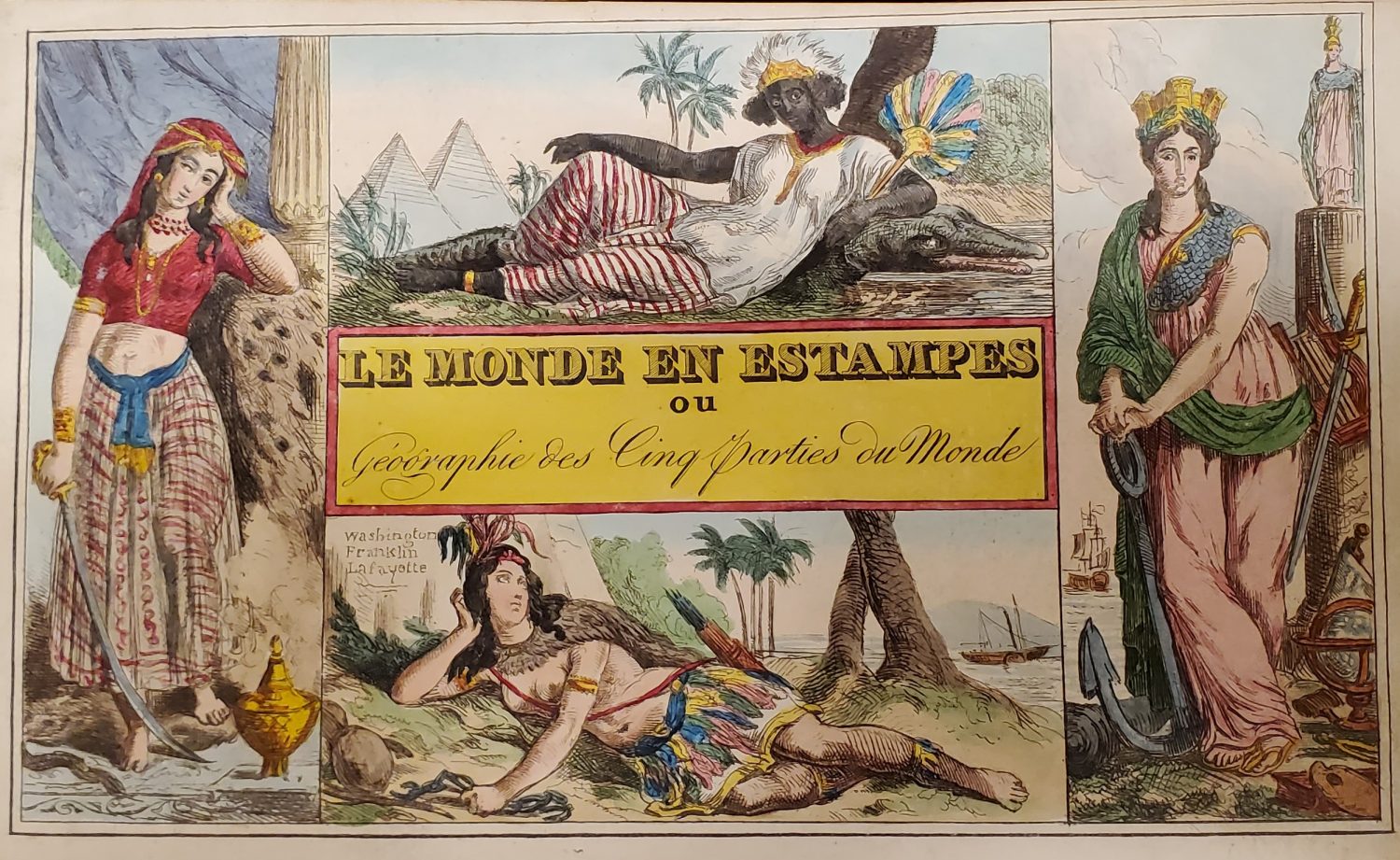
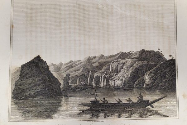
From 1828, the Baron Roujoux’s Le Mond en Estampes (“the world in prints”) subtitled: “for the instruction and amusement of the youth.” The continents are personified as women in stereotypical garb. From the Andersen Rare Books collection, call # 910 R757
Among the earliest geographical texts mentioned in Revolutions at Home is a “Singende Geographie” (“singing geography”) from 1708 – that is, a collection of rhyming verses about different areas of the world by Johann Christoph Losius (also Los). These verses were set to music by the composer Georg Philipp Telemann, who was a graduate of the Gymnasium Andreanum in Hildesheim where Losius taught. It is fascinating to find these pedagogical tools – the use of rhymes and music – in use in 1708, so I decided to try to track down this book, and, I hoped, a sound recording. (Unfortunately, the Bell does not own this book.) It proved to be a somewhat complicated task, as the international catalog records mix together the names Losius/Los, Telemann, and Adolf Hoffmann (a 20th-century commentator) as well as some associated instrumental musical pieces. The curator of the U of MN Music Library, Jessica Abbazio, kindly helped me decipher the records and find an on-line copy of Singende Geographie from the Bavarian State Library, through the Munich Digitalization Center.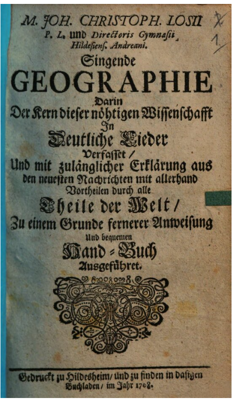
Although the U of MN Music Library has a recording of the “Klingende Geographie” (i.e. instrumental only), locating a “singende” (i.e. voice) recording was challenging. With help from our U of MN Libraries Interlibrary Loan detectives (thank you, Alice Welch!), we found a recording (in LP format) at the University of North Carolina, which they were willing to digitize and make available to me. Because of copyright considerations, I can’t make that recording available here, but I can just affirm that the music is charming. Though I can barely picture my own children singing along, I can imagine that it would have been cool for an 18th-century kid. Jessica also acquired the songbook by Georg Philipp Telemann, Singende Geographie: 36 Lieder für Singstimme und Generalbass zu dem gleichnamigen Handbuch des Johann Christoph Losius (Hildesheim, 1708), edited by Adolf Hoffmann (Wolfenbüttel, 1958) – words and music with an introductory essay – for the permanent collection.
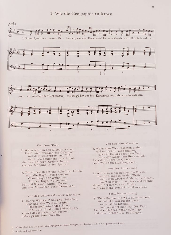
This song introduces children to the basic elements for learning geography: globes, world and regional maps, and latitude and longitude. Available in the Music Library, # Quarto M1621. T4 S6 1960
You can get a sense of the music for the songs by listening to the album on Youtube for the “Klingende Geographie” by Telemann.
As I was tracking down the Singende Geographie of Johann Losius, I also turned my attention to finding out what the Bell already has that seems to have been intended for children and youths, either directly or by association. These materials are certainly rare, and they are not always easy to find, as they are often not identified as being for children in the catalogue record. Emily Bruce’s survey of approximately 100 geographical texts from Germany between 1750 and 1850 demonstrated that before the mid-18th-century geographical texts were often “written without an age-specific readership” (89). I was therefore thrilled to find texts in the Bell collection, even from before the 18th century, that targeted children, youths, or “beginners.”
After examining Revolutions at Home, I broadened my reading to better identify books that had been used to teach children geography in prior centuries. Some authors point out that before the 18th century, children (of the elite) would have learned from adult books. While I don’t want to argue that every geographical or cosmographical text published in the early modern era might have been used as a juvenile pedagogical tool, I do think that it can shake up our conception of publishing history, and the uses of books, to consider children also as consumers of published works, even ones that were not specifically “for children.”
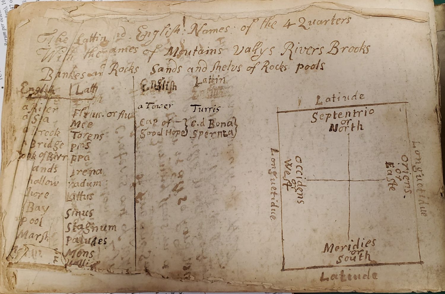
At the back of this early 17th-century book, Abraham Ortelius his epitome of the theater of the worlde (translated by Michel Coignet), an 18th-century learner has written key geographical terms, cardinal directions, and the concepts of latitude and longitude (creatively spelled) on the blank pages. Bell # 1603 sOr. The maps of this book have been digitized and are available in umedia.
For example, some of the epitome versions (reduced in size and abridged in content) of Abraham Ortelius’s original atlas, Theatrum Orbis Terrarum (Antwerp, 1570) (Bell # 1570 fOr) were prepared by men who operated schools for children. Ortelius’s friend, Piet Heyns, ran a school for girls, and his epitome translation was in rhyming couplets – a classic strategy to aid with memorization of details.
The Bell’s edition of the first English epitome, prepared by Michel Coignet [Abraham Ortelius his epitome of the theatre of the world (London, 1603) (Bell # 1603 sOr)] has numerous handwritten annotations in the margins and on spare pages, made by two previous owners. The unusual spellings and numerous factual mistakes made by the 18th-century hand suggests that this reader was a child. Few authors consider that this lauded atlas probably had humbler consumers as well.
Other texts, however, are more straightforward in their connection to the history of children’s geographical education. In addition to mining bibliographies in works like Revolutions at Home, I thoroughly searched the Bell Library catalogue, using keywords in several languages for children and youth: enfant, jeunesse, jugend, kinder, boys, girls, pueri, filius, joven, etc. So far, I have uncovered 18 items that I am comfortable calling geographical works aimed at children and youths.
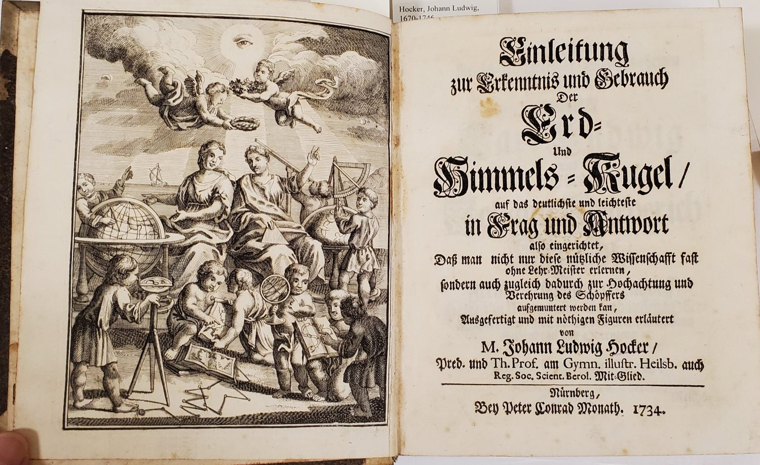
This volume is an “introduction to the use of celestial and terrestrial globes, taught in clear and easy questions and answers.” The frontispiece shows children, not just putti, busily at work with various cartographical instruments. The author was Johann Ludwig Hocker, who taught at the Gymnasium in Heilsbrun. Bell # 1734 Ho
Prior to the 18th century, Thomas Blundeville’s Exericises (London, 1606) (Bell # 1606 Bl) are “to be Read and Learned of All Young Gentlemen.” Granted, this audience was not necessarily children, yet certainly youths who were yet acquiring skills and knowledge to seek employment as merchants trading abroad.
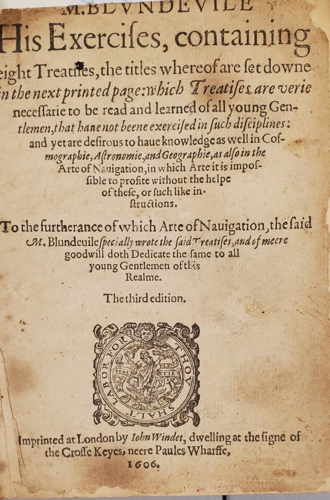
The lengthy title page. Bell # 1606 Bl
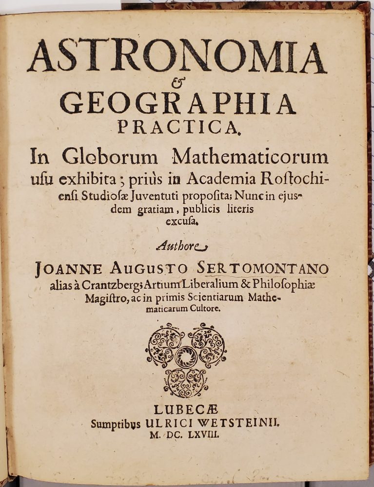
Title Page. Bell #1668 Se.
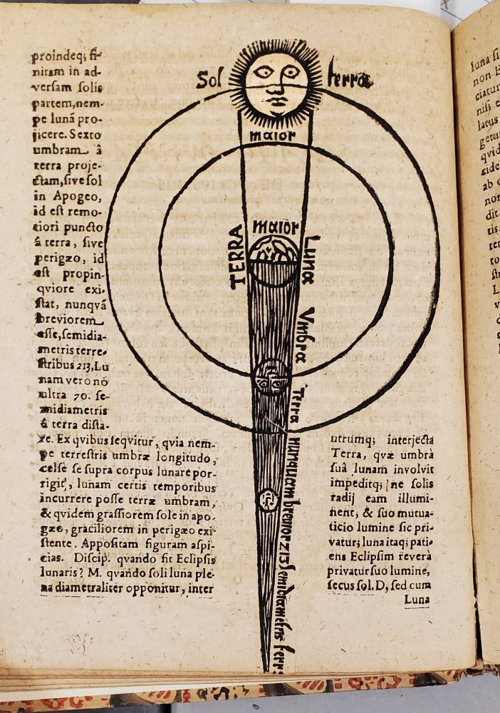
Celestial diagram in Sertomontano’s work. Note that these young scholars would have needed a good grasp of Latin.
Johannes Sertomontanus’s Astronomia & Geographia Practica: in Globorum Mathematicorum Usu Exhibita (Luebeck, 1668) (Bell # 1668 Se) certainly doesn’t rule out use by adults, but the long title refers specifically to the development of this instruction for the young students at the academy in Rostock (“prius in Academia Rostochiensi Studiosae Juventuti Proposita”).
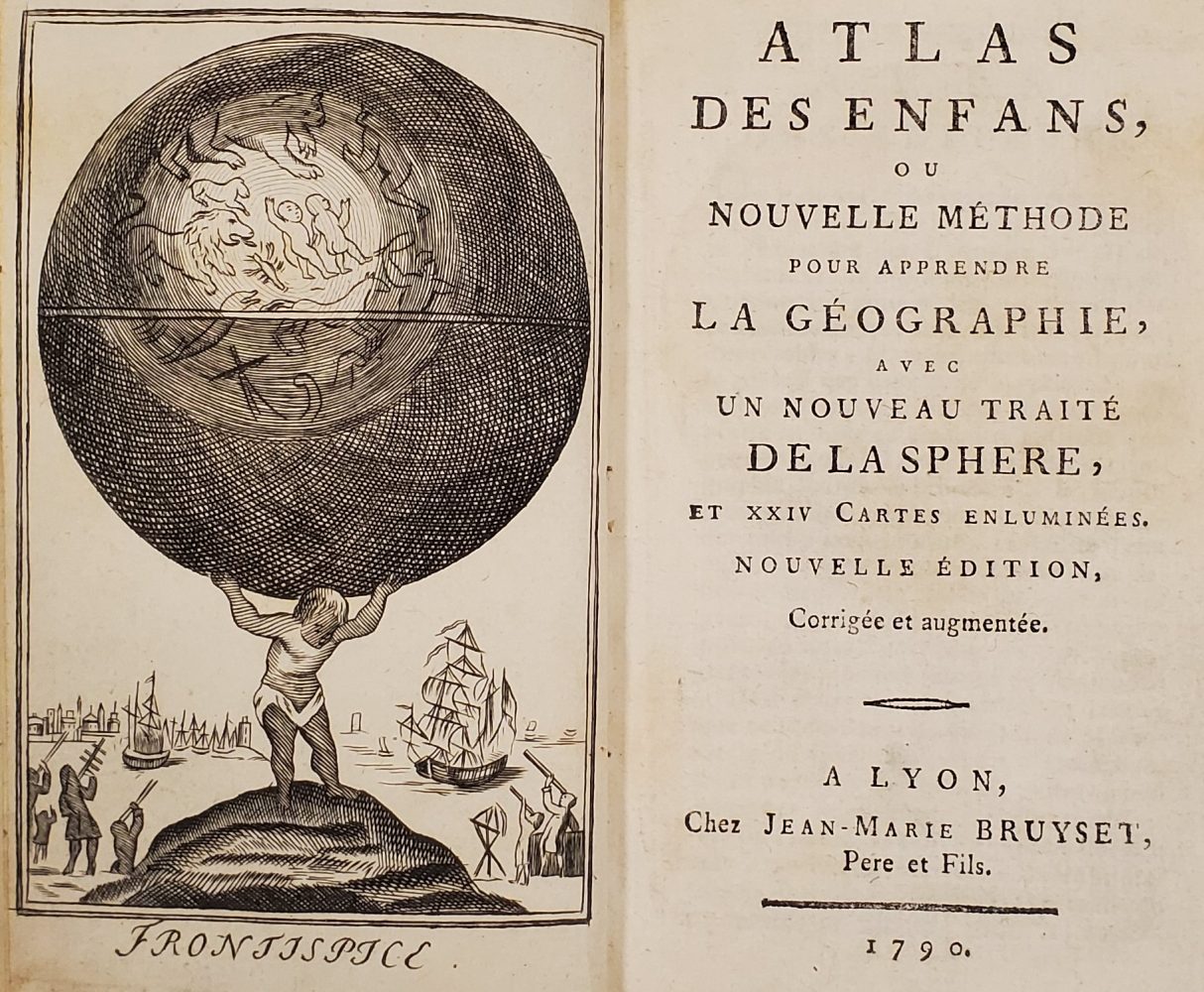
Frontispiece of Jean Marie Bruyset’s Atlas des Enfans (Lyon, 1790). Bell # 1790 At
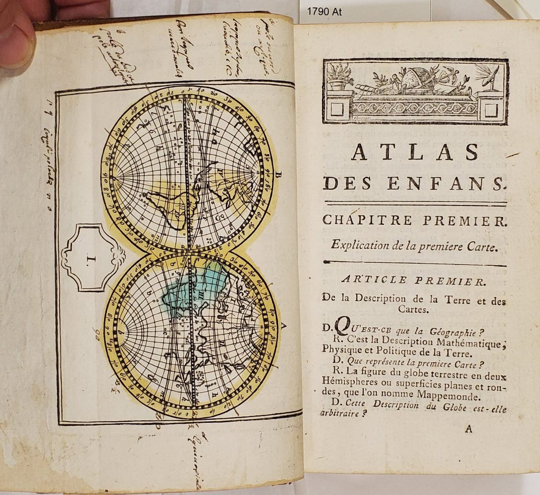
World Map at the start of Atlas des Enfans.
Most scholars of the history of children and childhood agree that publishing for children really took off after about 1740, and we can see a hint of this in the Bell collection (and even more so in the rare items in the Children’s Literature Research Collections and in Andersen Rare Books). More than half of our geographical works for children come from the later time period. These works include Geografia De Fanciulli Ovvero Metodo Breve di Geografia Accomodato Alla Capacità de Giovanetti by Nicolas Lenglet Dufresnoy (Venice, 1749) (Bell # 1749 Le); Atlas des Enfans by Jean Bruyset (Lyon, 1774 and 1790) (Bell # 1774 At and 1790 At); and An Introduction to Geography: for the Use of Mrs. Devis’s Little Society by Ellin Devis (London, 1790) (Bell # 1790 sDe). Mrs. Devis’s Little Society was her school for girls, and her little book was text only; meant to be used with globes and maps in the classroom.
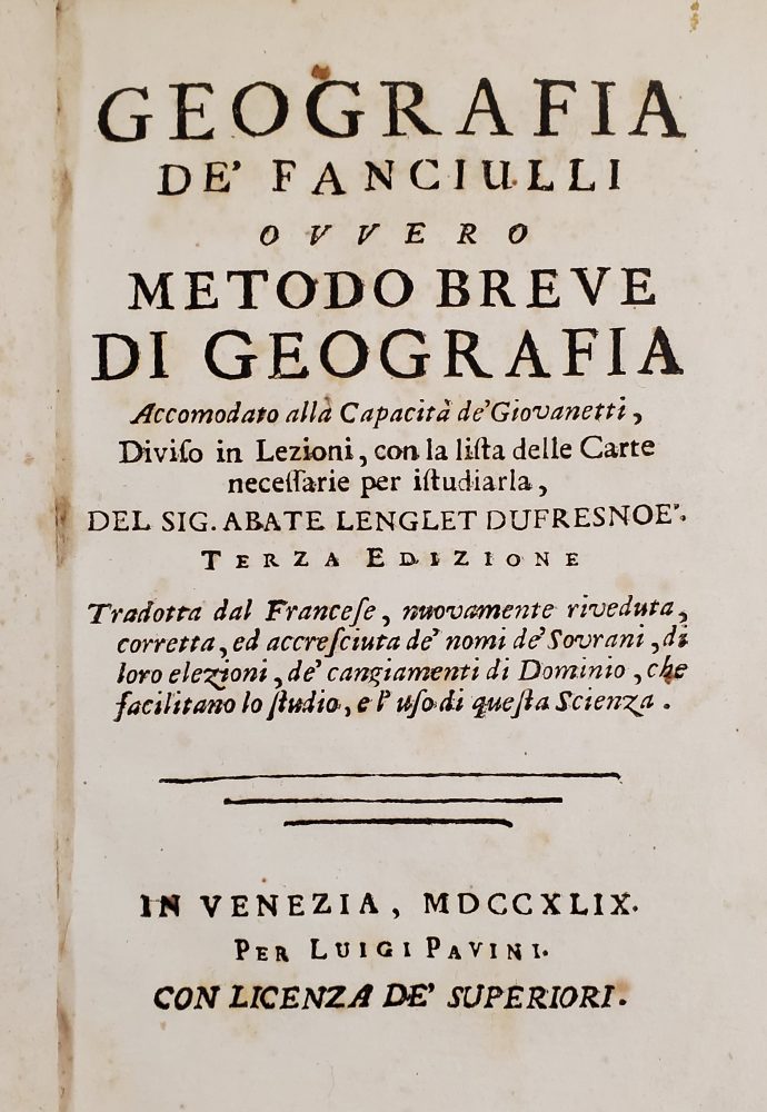
Geografia De Fanciulli Ovvero Metodo Breve di Geografia Accomodato Alla Capacità de Giovanetti by Nicolas Lenglet Dufresnoy (Venice, 1749). (Translated from an earlier French version.) Bell # 1749 Le
Beyond atlases for geographical instruction, by the late 18th-century, travel accounts were also being written, or revised, specifically for children. Notable in the Bell collection are: W.H. Dilworth, The History of the Conquest of Mexico, by the Celebrated Hernan Cortes … Published for the Improvement and Entertainment of the British Youth of Both Sexes (Glasgow, 1785) (Bell # 1785 Di); Joachim Campe and Georg Junker, La découverte de L’Amérique: Pour L’instruction & L’amusement des jeunes gens, 3 vols. (Geneva, 1798) (Bell # 1798 Cam); and I. G. Stedmann’s Reisen in Surinam : für die jugend bearbeitet von M. Chr. Schulz (Berlin, 1799) (Bell # 1799 Ste1). More of this genre of book may also be found in the Children’s Literature Research Collections (CLRC).
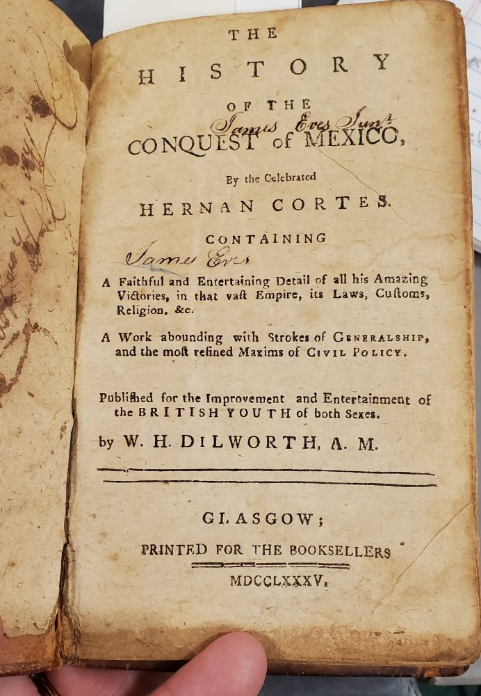
W.H. Dilworth’s retelling of the Spanish conquest of Mexico. Note the signatures of the previous owner. Bell # 1785 Di
But just because there was a great deal of publishing specifically for children in the 18th century does not mean that children did not continue to read or have read to them works that we typically consider to be adult material. We catch glimpses of children from time to time in a variety of works. One of my favorite notes in a rare book is the one below in the English translation of Peter Kolb’s The Present State of the Cape of Good-Hope (London, 1738) (in the copy from the Andersen Rare Books collection # 968.7 K83E).
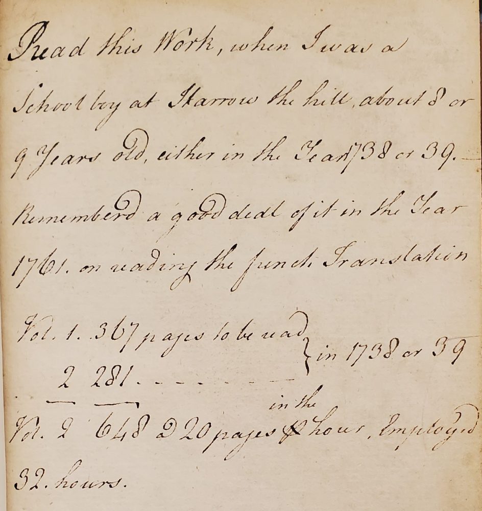
An annotation on the flyleaf of Peter Kolb, The Present State of the Cape of Good Hope (London, 1738). A former owner calculates how much time he spent reading the book when he was a boy. In the Andersen Rare Books collection # 968. 7 K83E
This post has provided a brief dip into a subset of materials in the Bell that open a window onto the history of children and childhood and the study of geographical education for young people. Those who are interested in these materials, will be pleased to know that CLRC and the Andersen Rare Books collection also have substantial pre-1840 holdings, in a variety of languages. With the help of Caitlin Marineau, CLRC Assistant Curator, and kalan Knudson Davis, Rare and Special Collections Metadata Librarian extraordinaire, I have created a “featured collection.” Here you can see the list of materials in each collection, and the catalog information for individual works. I hope this will provide a way to easily access these materials and encourage further research.