
Among the most wide-ranging explorers of the early modern era was the Dutchmen Jan Huyghen van Linschoten (1563-1611). Accounts of his voyages were published in large, beautiful books, well-illustrated, and often hand-colored as well. He became successful in both merchant and academic circles. Because Linschoten went virtually everywhere and was a well-known personage, the Dutch society dedicated to publishing historical and current travelers’ accounts is known as the Linschoten-Vereeniging.
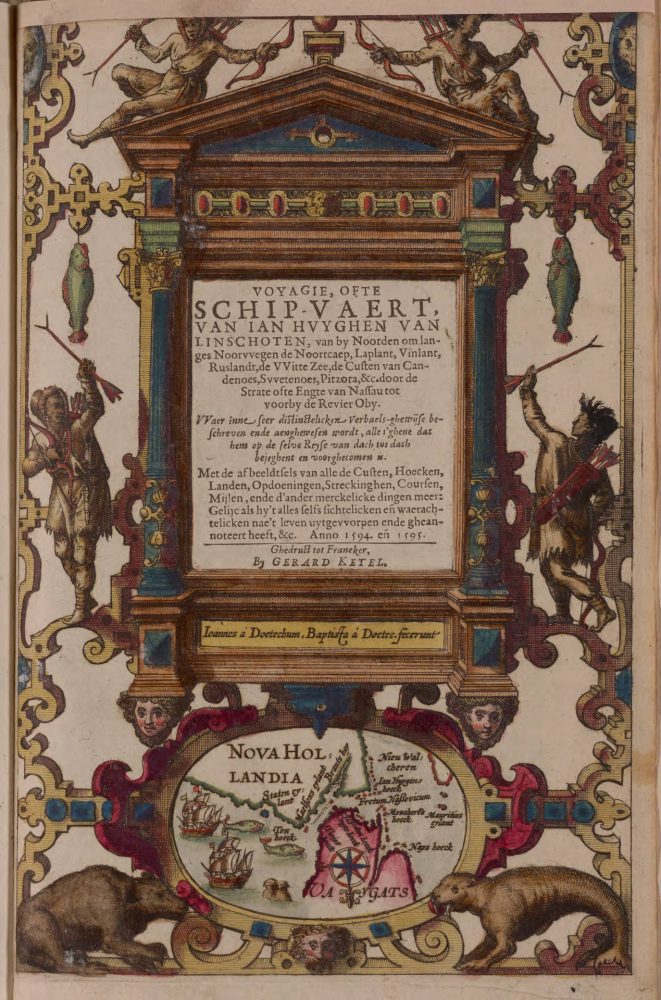
Title page of Linschoten’s voyage to the far north: Voyagie, ofte schip-vaert, van Ian Huyghen van Linschoten, van by Noorden om langes Noorvvegen (1611) Bell Call # 1601 fLi.
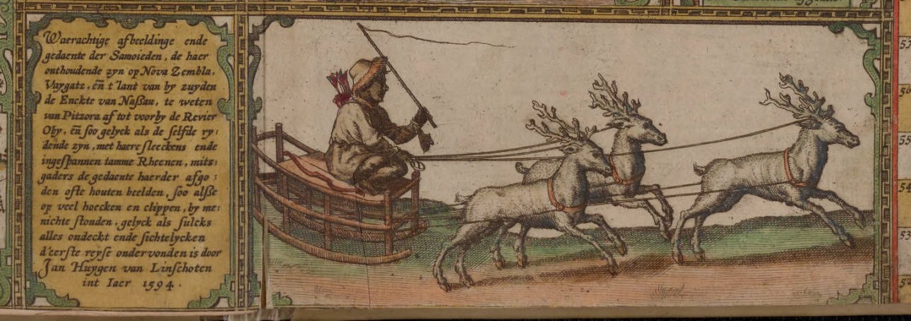
The Bell has several editions of Linschoten’s fascinating works. While exploring a map of the Arctic from a 1599 edition of Linschoten’s travels, I enjoyed reading a recent blog post by David Weimer, curator of maps at the Newberry Library. The Newberry’s version of Linschoten’s Arctic map is hand-colored, so the figure in red driving a team of reindeer really stood out! On the Bell’s version of this map the figure is much less conspicuous, but nevertheless, what a cool map.
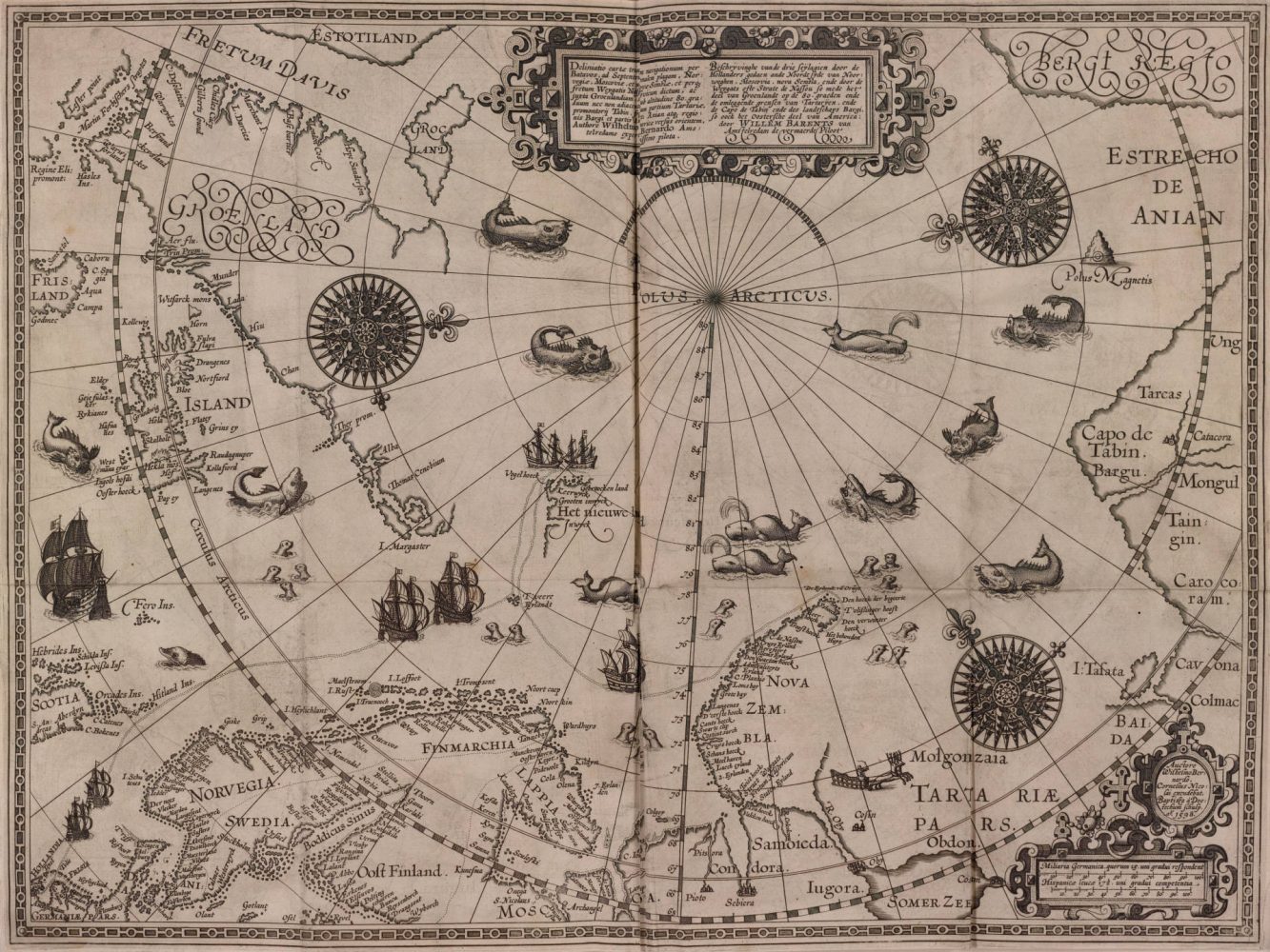
A map of the Arctic region from: Navigatio ac itinerarium Iohannis Hugonis Linscotani in Orientalem sive Lusitanorum Indiam (1599). Bell # 1599 fLi
Seasons Greetings from all of us at the James Ford Bell Library!