
By Anne Good, Assistant Curator
The map of “Virginia and Florida” published by Henricus Hondius, based on the work of his father, Jodocus, and Gerhard Mercator (Bell Call #1628 oMe, vol. 2) was not the earliest map of this region of North America, but it incorporates fine details gleaned (whether accurate or misunderstood) from some of the earliest European accounts and depictions.

The American Provinces of Virginia and Florida
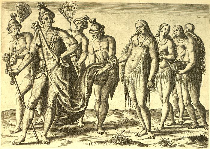
The portrait of the Timucuan chief and his wife can be traced to paintings by the Huguenot Jacques Le Moyne de Morgues, who traveled in the area of Northeast Florida in the 1560s.
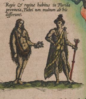
More directly, the image was copied from an engraving by Theodor de Bry. The image below is from the The Florida Center for Instructional Technology, University of South Florida, where all of the Le Moyne/De Bry depictions can be viewed. This description accompanies it: “The chief wears a painted deerskin and is followed by an attendant to hold his train. The chief and his wife are tattooed and have blue painted around their mouths. They wear red ornaments made from fish bladders in their ears and have sharpened their nails like animal claws.”
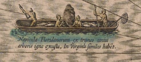
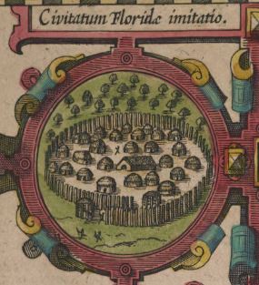
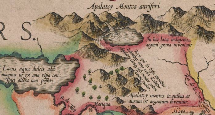
Also of interest on the map are:
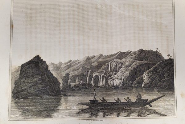
the dug-out canoe (made from a single tree trunk):
the Floridian village:
Appalachian mountains (bearing gold and silver):
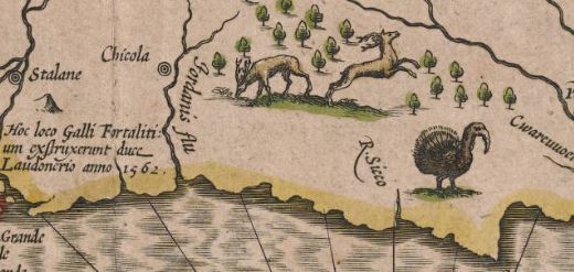
and a turkey:
Explore further: https://umedia.lib.umn.edu/item/p16022coll251:3346
I also recommend this fascinating book: A New World: England’s first view of America, edited by Kim Sloan (British Museum Press, 2007). Some of the images from the related exhibit may be found here.