

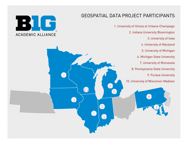
The Big Ten Academic Alliance Geospatial Data Project has launched the Big Ten Academic Alliance Geoportal. Collectively managed by a task force of librarians and geospatial specialists at 10 member institutions, thousands of metadata records have been aggregated and edited to connect scholars across the Big Ten to geospatial data resources, including GIS datasets, web services, and digitized historical maps from multiple data clearinghouses and library catalogs.
The interface offers both text and place-based search options, and item pages display descriptive metadata records along with external links to download, view, or read more about the resources.
Background
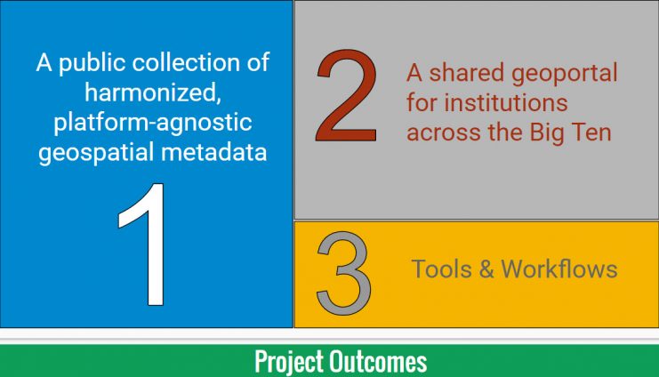
The Big Ten Academic Alliance Geospatial Data Project began in 2015 to provide discoverability, facilitate access, and connect scholars across the Big Ten Academic Alliance to geospatial data resources. The project’s current outputs include a public geoportal, a harvestable collection of well over 3000 geospatial records in a uniform metadata standard, and workflow documentation.
Collaboration
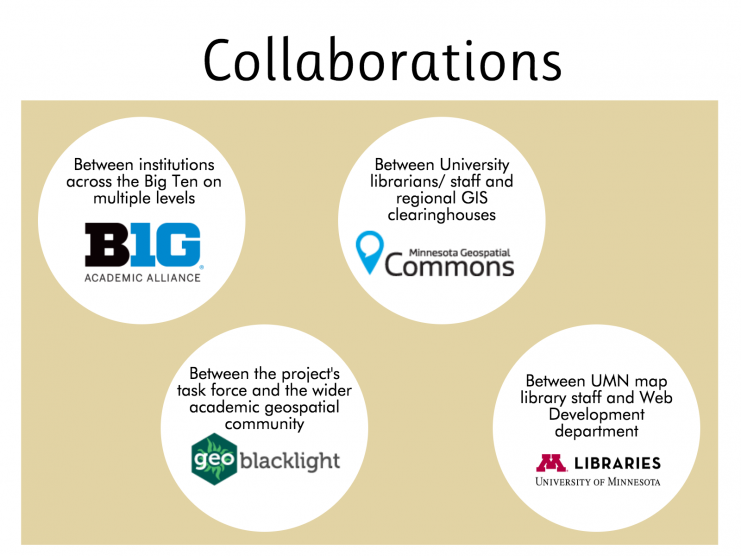 The core of this project is collaboration between many different groups.
There are over 20 task force members from 10 different universities working together to plan the project and build a collection of metadata records. Over the past year, task force members from different institutions have also worked together to deliver conference presentations, create posters, and publish papers about the project.
In many regions, the process of curating public geospatial records has served to strengthen the lines of communication between university library staff and local geospatial repositories. The task force members have been able to find out more about how GIS clearinghouses operate and offer their knowledge about best practices in metadata management.
The project is heavily supported by the dedicated resources provided by the University of Minnesota Libraries Web Development department. Both GeoNetwork and GeoBlacklight are hosted on local servers and both applications require extensive configuration profiles and a strong understanding of open source technology on the part of the Web Dev team.
Finally, the project has benefitted from many developments made across the growing geospatial community in recent years. In particular, it is indebted to the contributors of OpenGeoportal, GeoBlacklight, and OpenGeoMetadata.